Monday, November 30, 2015

Gov. McAuliffe Announces Major Improvements To The I-95 Corridor In Fredericksburg and Northern Virginia Regions

WASHINGTON, D.C. – Gov. Terry McAuliffe today announced major projects to improve transportation on one of the most heavily traveled corridors in the country – I-95 and I-395 in Northern Virginia. Improvements are planned for both ends of the 95 Express Lanes to ease the traffic bottleneck in Stafford County in the southern end and to extend the express lanes to the D.C. line in the northern end.
“These are significant transportation improvements that will move more people and commerce through an interstate corridor, and a critical jobs corridor,” said Gov. McAuliffe.  “In working with our private sector partner Transurban and local governments, we will fix the bottleneck on the southern end in Stafford County, and travelers will have the choice of taking an express trip from south of Garrisonville Road all the way up to the D.C. line. This represents a true multi-modal solution offering commuters a reliable trip so they can reach their destination faster in one the most congested regions of the country.”
Transportation Secretary Aubrey Layne added, “The projects are the result of the commonwealth’s engagement with our private-sector partner, the public and local officials to come up with the right transportation solutions that address the greatest needs and can be reasonably executed.  There is no one magic fix that resolves all problems. It takes a combination of additional capacity, express lanes and multi-modal improvements to move more people efficiently and safely.”
I-95 Express Lanes Southern Terminus
  • The project will extend 95 Express Lanes by approximately two miles past the point where the current flyover carries southbound traffic to Exit 143/Garrisonville Road in Stafford County. A reversible single lane would be built, eventually splitting into northbound and southbound merge ramps.
  • Southbound traffic in 95 Express Lanes will be able to continue driving past Exit 143 at Garrisonville Road. Southbound traffic will merge back into the mainline I-95 southbound lanes approximately 1,500 feet beyond the Garrisonville Road on-ramp to I-95 southbound. Traffic will merge into the left lane of I-95. This spacing will balance local and express lanes traffic entering I-95 southbound.
  • Northbound traffic can enter the 95 Express Lanes sooner. The new northbound entrance will be located approximately 1,000 feet before the I-95 northbound off-ramp at Exit 143 to Route 1 at Aquia. Northbound traffic will merge into express lanes from the left lane.
  • Construction is estimated to begin in 2016 and take two years to complete. Work will primarily take place within the median and within the existing right-of-way. No personal or business property should be affected.
I-395 Express Lanes Extension
  • The project will extend the 395 Express Lanes for eight miles north to the D.C. line. The project will convert and expand the existing HOV lanes on I-395 from Turkeycock Run north to the district to dynamically tolled express lanes.
  • An additional express lane will be built, providing three express lanes in the corridor.
  • There will be dedicated funding for new and enhanced transit services and carpooling incentives.
  • The work will be done by Transurban under the existing contract it has with the Virginia Department of Transportation.
  • Construction is expected to begin in 2017, with the extended lanes opening to traffic in 2019.
  • Vehicles with three or more people will continue to use the express lanes for free. Solo drivers will have the choice to take general purpose lanes for free or use the express lanes for a variable toll.

Friday, November 27, 2015

10 Magical Places Where There Are No Cars

Can you imagine a world without cars? Sure, they're useful. But they also cause pollution, noise and alter the structure of cities.
If you're sick of dealing with traffic and parking and spending money on gas, head to one of these 10 spots around the world that are off limits to cars. Grab a bike, lace up your walking shoes and enjoy!
1. Mackinac Island, Michigan
mackinac island
This island in Lake Huron banned all motorized vehicles back in 1898. Today it's a popular summer resort that attracts families, nature lovers and history fans. With only bicycles and horse-drawn carriages for transportation, the island has a decidedly vintage Americana feel.
2. Sark, United Kingdom 
sark
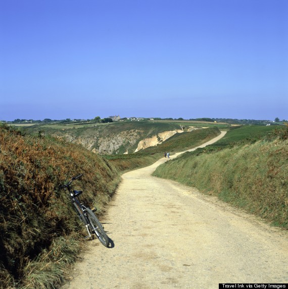
Off the coast of Normandy, France, Sark is part of the English Channel Islands. The island may be small, but it has no shortage of gorgeous landscapes and is perfect for hiking and biking. The only vehicles allowed on the island are tractors. Transport options include horse and carriage, cycling and walking.
Read the rest of the list at Huffington Post.

Wednesday, November 25, 2015

Two Programs Receive National Safety Awards

RICHMOND, Va. – The Virginia Department of Transportation (VDOT) received two 2015 National Roadway Safety Awards recognizing highway safety improvement projects from the Roadway Safety Foundation and the Federal Highway Administration during a ceremony held this week on Capitol Hill.
“We’re honored to receive these national awards recognizing projects that have improved the safety of Virginia’s roadways,” said VDOT Commissioner Charles Kilpatrick. “We continue to seek innovative and efficient ways to increase safety and improve traffic flow.”
Virginia-Specific Safety Performance Functions
VDOT’s Virginia-Specific Safety Performance Functions received an award in the Program Planning, Development and Evaluation Category. This program serves as a way to identify and prioritize locations that need safety improvements, allowing the agency to target available funds to projects that will have the greatest impact on highway safety. Each safety performance function compares crash frequency and site characteristics, such as traffic volume, to the typical performance of a similar roadway.
Road Diets in Reston
Roads Diets in VDOT’s Northern Virginia District received an award in the Infrastructure and Operational Improvements Category. In coordPhoto 2 - Soapstone afterination with scheduled repaving projects, VDOT engineers proposed adding road diets, the first in Northern Virginia, to two modestly traveled streets, Lawyers Road and Soapstone Drive (right) in Reston. 
A road diet involves removing travel lanes to use the pavement in a different way. In this case, the two streets were converted from four-lane undivided roads to one lane in each direction with left-turn lanes and bike lanes, making them more accessible to bikers and pedestrians. 
In its first five years, crashes on Lawyers Road dropped 69 percent while crashes on Soapstone Drive were reduced by 67 percent after three years.
The National Roadway Safety Award recipients were evaluated on effectiveness, innovation and efficient use of resources.

Tuesday, November 24, 2015

VDOT To Lift Lane Closures For Thanksgiving Travel


VDOT TO LIFT LANE CLOSURES FOR THANKSGIVING TRAVEL
Travel-trend map will help motorists plan ahead; go to 511virginia.org for the latest traffic and road conditions
RICHMOND, Va. – With a record number of travelers expected on the state’s roads during the Thanksgiving holiday, the Virginia Department of Transportation (VDOT) has several tools to help motorists plan their trips.
VDOT is suspending highway work zones during the five-day peak Thanksgiving travel period to reduce congestion on interstates and major highways. Lane closures will be lifted on most major roads in Virginia from noon Wednesday, Nov. 25, until noon Monday, Nov. 30.
Thanksgiving is one of the busiest times for travel each year, and VDOT urges motorists to plan ahead, drive safely and take a break when needed to ensure they reach their destination safely.
You can find real-time information about traffic, incidents and congestion on Virginia roads at 511Virginia.org.Download the free mobile VDOT 511 app, or call 511. To report a road problem or get answers to your transportation questions, call VDOT’s Customer Service Center at800-FOR-ROAD (800-367-7623) around the clock.
Travel-Trend Map Shows Historic Peak Holiday Congestion
VDOT’s online map of past travel trends shows peak congestion periods on Virginia interstates during the three previous Thanksgiving holidays (2012-2014). While the map cannot predict exact amounts of congestion for this year, you can use it as a guide to better time your travel.
Based on traffic data, the heaviest congestion during the most recent Thanksgiving holiday weeks occurred after 11 a.m. on Wednesday and from 10 a.m. to 10 p.m. on Sunday.
NORTHERN VIRGINIA HIGH OCCUPANCY VEHICLE (HOV) SCHEDULE
  • HOV restrictions will be lifted on Interstate 66 and Interstate 395 on Thursday, Nov. 26. Normal HOV restrictions will be in place on Wednesday, Nov. 25, and Friday, Nov. 27.
  • Direction schedule for Interstate 95 Express Lanes/I-395 reversible lanes:
  • Thursday, Nov. 26 – Lanes remain northbound all day.
  • Friday, Nov. 27 – Lanes close to northbound traffic at 11 a.m. and will reopen to southbound traffic by 1 p.m.
More information on Northern Virginia HOV schedules can be found at http://www.virginiadot.org/travel/hov-novasched.asp. For information on the 95 and 495 Express Lanes, visit http://www.expresslanes.com. Drivers are reminded that they need an E-ZPass Flex (for HOV-3 to ride toll-free) or an E-ZPass to use the express lanes at all times.
HAMPTON ROADS HOV SCHEDULE, TUNNELS
  • I-64/I-264/I-564 HOV diamond lanes – HOV restrictions will be lifted on all HOV diamond lanes on Thursday, Nov. 26.
  • I-64 reversible lanes − Lanes will operate on the regular schedule with no HOV restrictions on Thursday, Nov. 26.
I-64 Hampton Roads Bridge-Tunnel (HRBT) – Motorists traveling to Virginia Beach are encouraged to use the Interstate 664 Monitor-Merrimac Memorial Bridge-Tunnel (MMMBT) as an alternative to the HRBT. To Virginia Beach, take I-664 south to the MMMBT. Then take the Portsmouth/Norfolk exit (exit 15A) to I-264 east to Virginia Beach.
Travel to Outer Banks – Motorists going to the North Carolina Outer Banks should use I-664 and the MMMBT to save time. From I-664 south, take I-64 west to exit 292, Chesapeake Expressway/Interstate 464/Route 17. Keep left tocontinue to the Chesapeake Expressway (Route 168), and take Nags Head/Great Bridge (exit 291B) to the Outer Banks.
Highway Advisory Radio (HAR) – Tune to 1680 AM to stay informed on Hampton Roads traffic, travel conditions and construction information.
WORK ZONES AND OTHER TRAFFIC ALERTS
While VDOT will lift most lane closures during the Thanksgiving holiday period, motorists may encounter permanent work zones or travel delays in the following locations:
Accomack County
Route 609 – Road closed for widening project. Use detour.
Albemarle County/ Charlottesville
U.S. 29 – All lanes will be open through the Route 29 Solutions construction projects. Watch for reduced speed limits and narrowed lane widths in work zones.
Amherst County
U.S. 501 – Replacing bridge at Route 130 intersection over James River. Traffic controls and flaggers in use.
Augusta County
U.S. 250 – Replacing bridge at Calfpasture River on Hankey Mountain Highway. Traffic restricted to one lane with temporary signals.
Bristol
U.S. 11 – Improving two sections near Interstate 81, exits 5 and 7. Watch for delays.
Charles City County
Route 5 – Replacing bridge over Herring Creek. Temporary signal directing traffic.
Culpeper County
Route 3 – Traffic is expected to be switched to the newly paved lanes between Lignum and Route 669 (Carrico Mills Road). Speed limit reduced to 45 mph in work zone.
Dinwiddie County
Route 226 – Replacing bridge 0.3 miles east of Route 460. Temporary signal directing traffic.
Essex County
U.S. 17 − Improving drainage, from just south of Airport Road near June Parker Marina to just north of Marsh Street. Traffic reduced to one lane both directions.
Frederick County
Interstate 81 – Reconstructing interchange at exit 310. Speed limit through work zone reduced to 60 miles an hour.
Giles County
U.S. 460 – Westbound lane closures in place beginning west of Route 42 (mile marker 22) and ending at Route 730 (mile marker 26.5).
Greensville County
U.S. 301 – Replacing southbound bridge over rail tracks north of Emporia. Traffic detoured to I-95.
Hampton
I-664 at I-64- Right lane closed from Interstate 664 northbound entrance ramp to westbound I-64.
Madison County
Route 231 – Replacing bridge over Mulatto Run. Traffic restricted to one lane controlled by temporary signals.
Portsmouth
Interstate 264 – Right lanes closed both directions between Portsmouth Boulevard and Effingham Street. Two lanes open to traffic.
Richmond
U.S. 360 – Replacing bridge deck. Traffic limited to two lanes on Mechanicsville Turnpike over Interstate 64, with one travel lane each direction. Ramp from eastbound U.S. 360 to I-64 westbound remains closed. Follow posted detour.
Roanoke
Interstate 581 – Northbound right lane closed from 10th Street to Liberty Road approaching the Valley View Mall. Shoulders closed, barricade walls in place. All lanes on Valley View Boulevard will be open.
Rockbridge County
Interstate 64 – Rehabilitating Maury River bridge. Eastbound traffic will detour across median to westbound lanes between mile markers 53.3 and 55.3. Traffic both directions will use westbound bridge during work on eastbound bridge.
Wythe County
Interstate 77/Interstate 81 overlap – High traffic volumes could slow or stop vehicles through this eight-mile stretch. Be alert for delays on northbound I-77 at the I-81 merge.

Thursday, November 19, 2015

VDOT, Virginia Tech Partner to Accelerate Pavement Testing

BLACKSBURG, Va. – The Virginia Department of Transportation (VDOT) today flipped the switch to start a new program that will cut years off the time needed to test the response of innovative pavements to the daily impacts of heavy traffic.
This heavy vehicle simulator is the technological heart of VDOT's new accelerated pavemennt testing program.VDOT’s “accelerated pavement testing” program, which launched today at the Virginia Tech Transportation Institute (VTTI), employs a “heavy vehicle simulator” as its technological centerpiece.
“We located this program at VTTI because VDOT has a long and productive relationship of collaborating with Virginia Tech on transportation projects, especially through our respective research programs,” said VDOT Commissioner Charlie Kilpatrick. “The accelerated pavement testing program will provide VDOT and Virginia Tech with training and education benefits as we study more strategic and cost-effective options to save money on longer-wearing pavements. We also are gratified to have Virginia Tech as our partner in this new venture.”
“VDOT and VTTI have a successful and extensive record of partnering to bring about substantial improvements in the transportation system, said Dr. Tom Dingus, director of VTTI. “Collectively, we have created the resources necessary to test and develop myriad applications, from next-generation vehicular technology to infrastructure improvements. By launching the use of a state-of-the-art accelerated pavement testing program today, we will expand on this work by helping to maintain and sustain the literal foundation of driving.”
The heavy vehicle simulator will run a wheel assembly – which applies a heavily weighted load to a test pavement – back and forth, day and night, for several months over a 10-foot-wide by 100-foot-long pavement section to simulate the wear and tear induced by repeated passes of heavy trucks on a highway.
The weighted wheel assembly is on the underside of the heavy vehicle simulator.Other states with similar accelerated pavement testing programs have realized significant savings in their road maintenance andrehabilitation projects. The savings come primarily from being able to more quickly implement the recommended changes in pavement designs and paving schedules.
The accelerated pavement testing program will enable VDOT to determine how different pavement designs and new materialsrespond to load testing before putting them on the road.
These include:
  • Pavements with increased content of recycled paving materials;
  • Different additives or binders to increase a pavement’s service life; and
  • Improved configurations of pavement layers under the driving surface for better performance.
The program also will allow VDOT’s and Virginia Tech’s pavement experts to develop better methods of placing instrumentation in new and rehabilitated pavements to monitor their response to heavy vehicle traffic.
Most importantly, the new program will help increase safety for road workers and the traveling public. Using the simulator to test new pavements will reduce the need to close travel lanes to drill pavement cores or conduct other testing, reducing the risk of injuries to VDOT workers as well as motorists.

VDOT’s Budget, Equipment In Place For Winter

RICHMOND –The Virginia Department of Transportation (VDOT) is geared up for snowy weather with staffing, equipment and materials ready to go for the 2015-2016 winter season.
“VDOT prepares year-round for snow so that we can keep Virginia’s complex network for roads and bridges clear for travel when bad weather strikes,” said VDOT Commissioner Charlie Kilpatrick.  “Our crews are trained and experienced to handle the worst of storms and we have the resources and technology to get the job done safely.”
Snow removal resources:
  • $202.4 million budget for winter weather 
  • 2,500 VDOT crewmembers in addition to contractors available for snow removal statewide
  • 13,173 pieces of snow-removal equipment, including trucks, loaders and motor graders
  • 657,162 tons of salt, sand and treated abrasives and 1.7 million gallons of liquid calcium chloride and salt brine

What’s new and other innovations: 
Wing plows - Four trucks in the Staunton District will test a wing plow for snow removal.  Each truck will be fitted with a front and side blade.  Together the plows will cut a 21-foot path of snow with each pass, essentially doing the job of two traditional plows.
Online snowplow tracker in Northern Virginia- If snow reaches two inches or more, VDOT activates an online neighborhood tracking map that monitors the status of plowing in the Northern Virginia district.
Recycling runoff into brine -When VDOT loads salt onto snow-removal trucks on a paved area – called a “mixing pad” – at its salt-storage facilities, the runoff is directed either to impermeable ponds or underground tanks, since the mixing pad is normally wet during the loading process due to water or snow.
To manage this runoff, VDOT is reusing some of this water from the ponds or tanks to produce brine, a solution of salt and water, to turn an environmental challenge – disposing of that runoff – into a supply opportunity.
VDOT has begun to rely more on applying brine to roads in areas where feasible before winter storms. Brine can prevent frozen precipitation from bonding to the pavement, and it reduces the overall amount of salt used. Brine is also more environmentally friendly than salt.
Most salt facilities in VDOT’s Richmond District now recycle this runoff into brine.  The district used more than 193,000 gallons of brine last winter, most of which came from runoff processed from its holding ponds.
Online:
Go to VDOT winter weather for more information.  Watch VDOT prepares for snow. Call 511 or go to511virginia.org for the latest road conditions and traffic information.

Wednesday, November 18, 2015

VDOT, Partners Train For Mountain Tunnel Emergencies

BRISTOL— The Virginia Department of Transportation (VDOT) and Transportation Operation and Management, LLC, VDOT’s partner in emergency response for the I-77 mountain tunnels, recently hosted a training exercise involving real-world possibilities and how best to respond
From a scenario involving an accident with four-hour delays on a major holiday weekend to a truck losing its loadinside the tunnel on a snow day, each scenario was reviewed and discussed among local fire, police, Virginia Department of Emergency Management, Virginia State Police and VDOT.
“Every scenario presented different challenges, agency responses and communication needs,” Tim Martin, VDOT Regional Traffic Operations Manager, said. “By staging these scenarios we see where the gaps may lie and what needs to be done to prepare should the scenarios actually occur.”
VDOT staff and TOM held two scenarios this fall, one specific to East River Mountain Tunnel and one for Big Walker Mountain Tunnel.
“It was beneficial to hold separate exercises because the tunnels are distinct,” Martin said.  “With East River Mountain Tunnel being shared between the two states, it presents communications challenges that may not be the same for Big Walker Mountain Tunnel.”
Earlier mock exercises have led to beneficial changes, such as the addition of the fire trucks and trained fire staff at each tunnel as well as the addition of a radio system at each tunnel to communicate with first responders.
“We will always need the help of local fire and EMS when an incident arises, but past mock exercises helped VDOT see how crucial adding the fire trucks and radio system would be to providing a quicker response and better protection.”
Interstate 77 Big Walker Mountain Tunnel opened to traffic in 1972 and East River Mountain Tunnel in 1974.  On average, approximately 30,000 vehicles per day pass through the tunnels.

Tuesday, November 17, 2015

Deer Alert! It’s Deer-Mating Season, So VDOT Urges Drivers To Watch For Wildlife In The Road

RICHMOND, Va. – Virginia drivers have a 1-in-97 chance of hitting a deer, according to recent insurance industry claims data for July 2014 through June 2015, ranking the state 10th in the nation for deer-vehicle collisions.

Motorists could see those odds increase as deer-mating season gears up now through December. The three-month mating season can lure many unsuspecting deer onto state roadways, mostly between dusk and dawn, and they are oblivious to the danger of high-speed vehicles.

“Collisions with animals typically cause a good deal of damage to vehicles, and can also cause injury to drivers and their passengers,” said Virginia Department of Transportation Commissioner Charlie Kilpatrick, “It’s very important for motorists to stay alert to their surroundings this time of year, especially when traveling at dusk or dawn.”

VDOT research aims to reduce deer-vehicle collisions

While VDOT always asks drivers to watch for wildlife on the road year-round and especially in the fall, the agency is working to help reduce the frequency of animal-vehicle collisions. VDOT has studied various cost-effective measures to protect both drivers and animals along major wildlife corridors that crisscross Virginia’s roads and highways.

New VDOT research, which analyzed three years of wildlife activity near Interstate 64 on Afton Mountain, recommends posting messages on electronic signs along I-64 in this area to alert drivers to increased deer activity in the fall. VDOT began posting these alerts on Monday, Oct. 26, on permanent signs in this section of I-64 between dusk and dawn through November, when deer are most active near the highway.

The report evaluating strategies to reduce deer-vehicle collisions – by the Virginia Transportation Research Council, VDOT’s research division – is available at http://vtrc.virginiadot.org/PubDetails.aspx?PubNo=16-R4.

How to avoid a deer-vehicle collision

Deer generally travel in groups. If you see one deer near or on the road, watch out for others nearby.

More driver tips:
  • Drive the speed limit or reduce your speed when you see deer-warning signs
  • Watch for deer between dusk and dawn, especially from October through December
  • Use bright headlights when appropriate
  • Watch for animal eyes illuminated by headlights
  • Maintain control of your vehicle when you see a deer, to avoid veering into oncoming traffic or off the road
  • Always wear your seatbelt

If you hit a deer, you should contact law enforcement in the jurisdiction where the accident occurred. If the animal is dead, you can keep the carcass after you have reported the accident, and an officer has seen the animal and provided a certificate of possession.

Monday, November 2, 2015

Public Input Sought On Prioritizing Transportation Projects

RICHMOND – The Commonwealth Transportation Board (CTB) will hold nine public meetings across the commonwealth in November on prioritizing transportation projects.
The public is invited to get the latest information, ask questions and provide input on transportation projects. This year’s meetings will consist of an open house format where attendees can review and provide feedback on the list of proposed local and regional projects that localities submitted to be scored under a new prioritization process as legislated by House Bill 2. 
Following the open house, a town hall style format will be provided where the public and transportation stakeholders can engage in discussion and ask questions about the projects. There will be no formal public comment during the meetings.
Signed into law by Gov. Terry McAuliffe, House Bill 2 is a consistent and data-driven “prioritization” process to score projects according to critical transportation needs.
The meetings will highlight the 321 applications for projects submitted by 131 local and regional governments across the state. The applications request $6.95 billion in funding under House Bill 2.
Following public meetings, the projects will be scored through the end of December. Once projects are scored and reviewed by the public, the CTB will then select which projects to fund and be included in the next Six-Year Improvement Program by June of 2016.
Public Meetings 
Monday, November 2
4 to 6 p.m.
3005 Linden Drive
Bristol, VA 24202 
Monday, November 9
4:30 to 6:30 p.m.
The Kirkley Hotel
2900 Candlers Mountain Road
Lynchburg, VA 24502
Tuesday, November 10
4:30 to 6:30 p.m.
Hampton Roads Transportation Planning Organization Boardroom
723 Woodlake Drive
Chesapeake, VA 23320 
Thursday, November 12
5 to 7 p.m.
Center for Workforce & Community Education
10000 Germanna Point Drive
Fredericksburg, VA 22408

Monday, November 16
6 to 8 p.m.
VDOT Northern Virginia District Office
4975 Alliance Drive
Fairfax, VA 22030
Wednesday, November 18
4:30 to 6:30 p.m.
Holiday Inn Valley View
3315 Ordway Drive NW
Roanoke, VA 24017
Thursday, November 19
4:30 to 6:30 p.m.
Augusta County Government Center, South Boardroom
18 Government Center Lane
Verona, VA 24482
Monday, November 23
4:30 to 6:30 p.m.
Germanna Community College
Daniel Technology Center
18121 Technology Drive
Culpeper, VA 22701
Monday, November 30
4:30 to 6:30 p.m.
Eastern Henrico Recreation Center, Strawberry Hill Ballroom
1440 North Laburnum Avenue
Henrico, VA 23223

If you are unable to attend a meeting, you may view the displays and provide your comments online.

You can also mail comments on rail, public transportation and transportation demand management toPublic Information Officer, DRPT, 600 E. Main St., Suite 2102, Richmond, Virginia 23219, orDRPTPR@drpt.Virginia.gov and on highway projects to Infrastructure Investment Director, VDOT, 1401 E. Broad St., Richmond, Virginia 23219, or Six-YearProgram@VDOT.Virginia.gov.
Comments will be accepted until Dec.11, 2015.

I-66 Outside The Beltway Design Concept Approved By Commonwealth Transportation Board Private Sector Teams Identified for I-6

VIRGINIA BEACH, Va. - The Commonwealth Transportation Board (CTB) approved today the recommended design concept, known as the “Preferred Alternative,” for the I-66 Outside the Beltway Project, as well as a phased implementation approach. The preferred alternative is a combination of various alternatives that were evaluated over the past year to improve 25 miles of I-66 from I-495 in Fairfax County to Route 15 in Haymarket. These multimodal improvements, which reflect extensive public input received at nearly 200 public meetings held since January 2014, are expected to move more people throughout the I-66 corridor, reduce hours of congestion per day, and reduce cut-through traffic on local roads.

The preferred alternative consists of two express lanes alongside three regular lanes in each direction, with space in the median for future transit; dedicated express lanes access points; safety and operational improvements at key interchanges throughout the corridor; new transit services such as new and expanded park and ride lots and bus service; and corridor-wide bikeway, trail, and sidewalk improvements. Due to the cost and complexity of the proposed improvements, the CTB has approved a phased implementation approach. Phase 1 extends the express lanes for 22 of the original 25 miles, from 495 to Gainesville, (University Boulevard), and then transitions to a traditional HOV lane in each direction. Phase 1 also proposes retaining existing ramps and bridges, and converting them to express lanes access points, at Monument Drive and Stringfellow Road, rather than rebuilding these interchanges. Future phases, which include extending the express lanes to Route 15 in Haymarket and rebuilding the Monument Drive and Stringfellow Road interchanges, would be implemented in the future as funding becomes available and demand warrants.

The design concepts have been evaluated in a draft Environmental Assessment, which was presented at public hearings in May and June 2015. The concepts reflect design changes that are largely based on public input, including:

  • Reductions in potential residential relocations from 35 to 11
  • Elimination of major impacts to Stenwood Elementary School
  • Reconfiguration of the I-495 Interchange to reduce property impacts
  • Refinements of design for Route 28 Interchange and I-66 to reduce impacts to parks

The final environmental document is expected to be completed, along with a decision on the procurement approach, by the end of this year. VDOT, as well as its private partner or contractors, will continue to evaluate specific design alternatives, and anticipate doing so under an upcoming Alternative Technical Concepts (ATC) process. This would include roadway elements, as well as proposed park and ride lots that are part of the project.

The public again will have an opportunity to provide formal comments and input into the project’s design at a Design Public Hearing in early 2017. Throughout the project’s development, outreach with the public, technical experts from affected localities, transit partners, and other key stakeholder groups, will continue to be robust. Construction of the project is slated to begin in 2017, with the improvements open to traffic in 2021.